
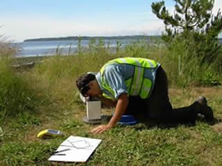
Graduate student James Taylor collecting gravity data on Washington’s west coast.
This USGS-NEHRP funded study aims to trace out the locations and linkages among fault systems in two regions of the Puget Sound Lowlands in Western Washington State using gravity and magnetic modeling. The project is being conducted in collaboration with the U.S. Geological Survey (R. Blakely and B. Sherrod) and the University of Washington (M. Brown), and involves the collection of new gravity data. Targeted areas are the Bellingham Basin and the Muckleshoot Basin, east of Tacoma. Holocene-active crustal faults observed in outcrop and inferred from geophysical data appear to continue beneath these basins, but their structural configuration within the basins is unknown. Preliminary results reveal that the Bellingham basin may be highly segmented by through-cutting faults, most pronounced along the Birch Bay fault system. Work on the relation of the Tacoma fault to the White River and Green River fault systems is ongoing.